Metro and bus network maps
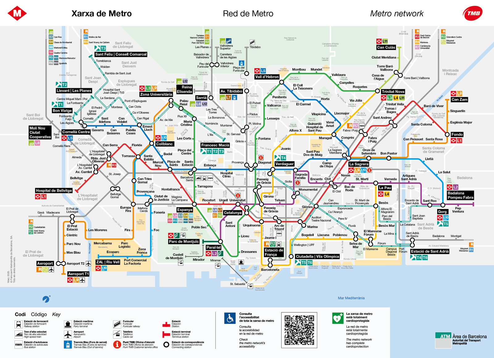
Plan your journey by consulting the updated maps of the entire metro and bus network of Barcelona, as well as the map for each metro route.
-
Metro Barcelona network map
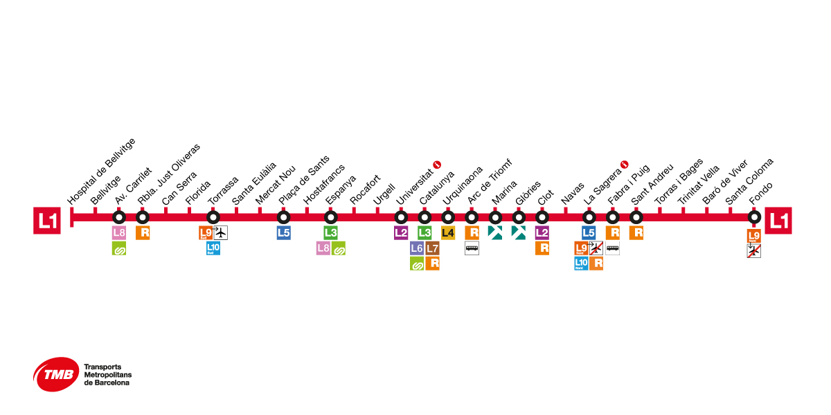
L1 metro map
Barcelona's red metro line, Line 1, connects the municipalities of Hospitalet de Llobregat, Barcelona, Santa Coloma de Gramenet and Badalona. On its way through Barcelona, L1 of the metro, the red line, unites the districts of Sants-Montjuïc, Eixample, Ciutat Vella, Sant Martí and Sant Andreu.
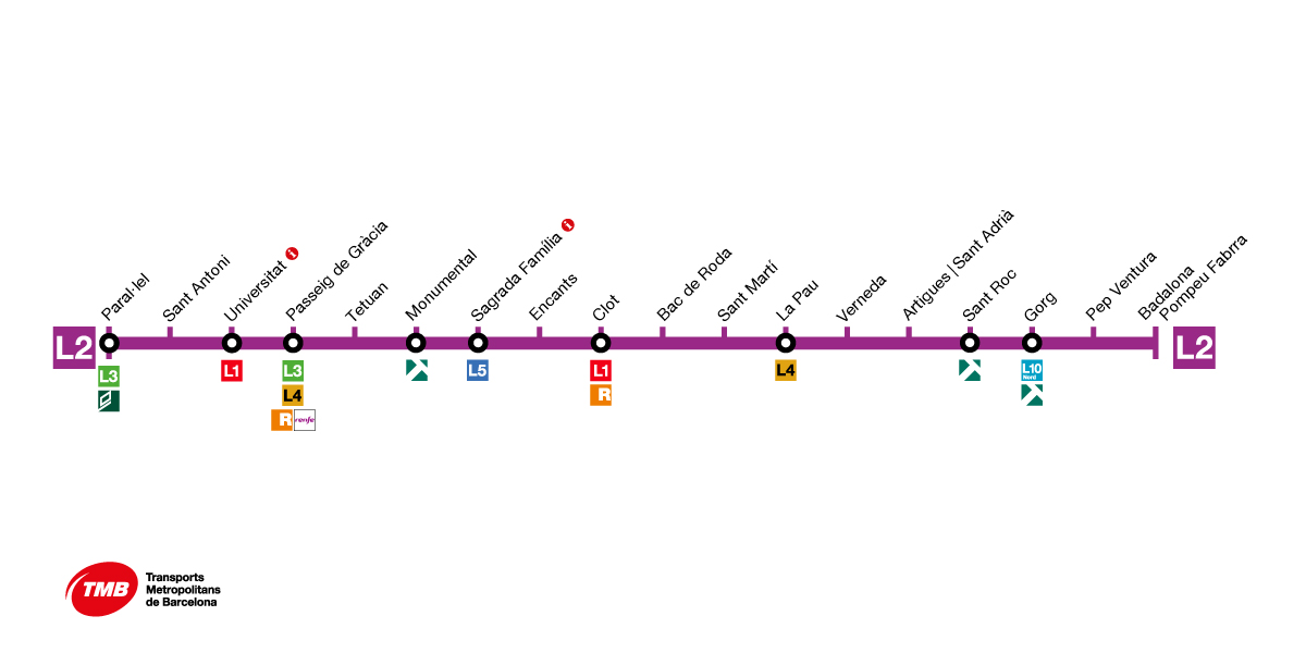
L2 metro map
Barcelona's purple metro line, Line 2, connects the municipalities of Barcelona, Sant Adrià de Besòs and Badalona. On its way through Barcelona, the L2 metro line, the purple line, unites the districts of Ciutat Vella, Eixample and Sant Martí.
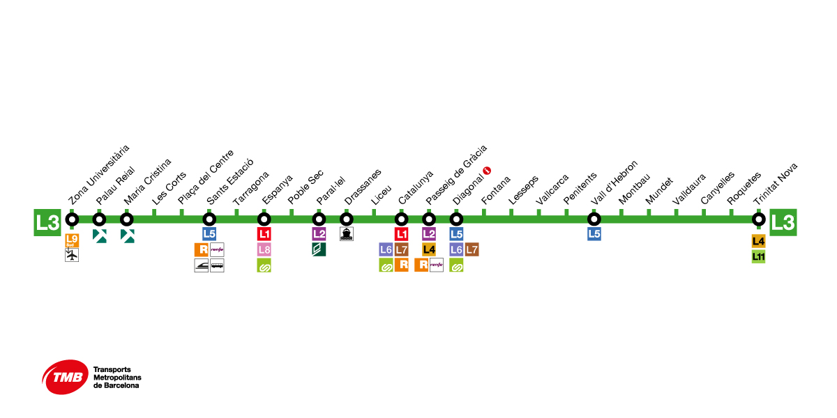
L3 metro map
Barcelona's green metro line, Line 3 links the districts of Les Corts, Sants-Montjuïc, Ciutat Vella, Eixample, Gràcia and Horta-Guinardó.
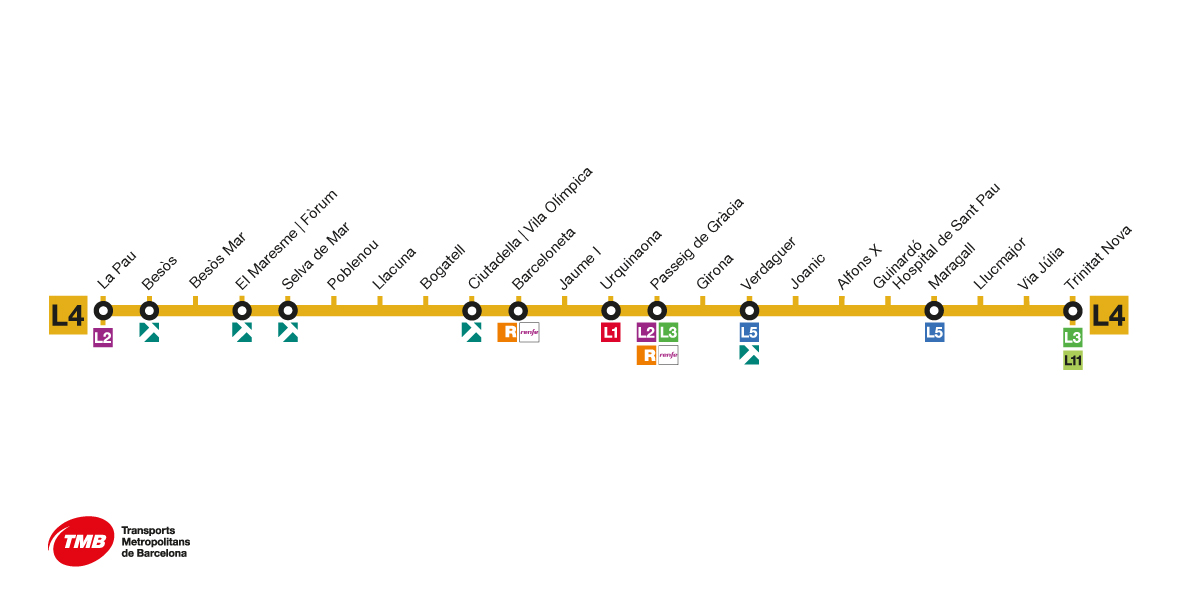
L4 metro map
Barcelona's yellow metro line, Line 4, links the districts of Sant Martí, Ciutat Vella, Eixample, Gràcia, Horta-Guinardó and Nou Barris.
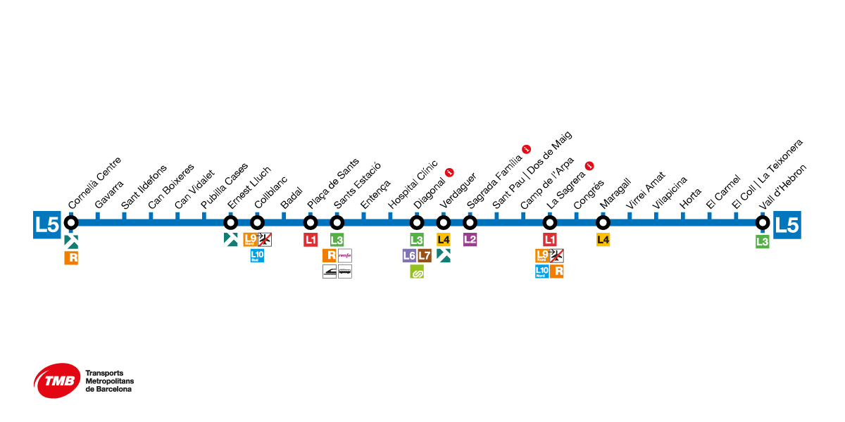
L5 metro map
Barcelona's blue metro line, Line 5, connects the municipalities of Cornellà de Llobregat, L’Hospitalet de Llobregat, Esplugues de Llobregat and Barcelona. On its way through Barcelona, L5 of the metro, the blue line, unites the districts of Sants-Montjuïc, Eixample, Nou Barris and Horta-Guinardó.
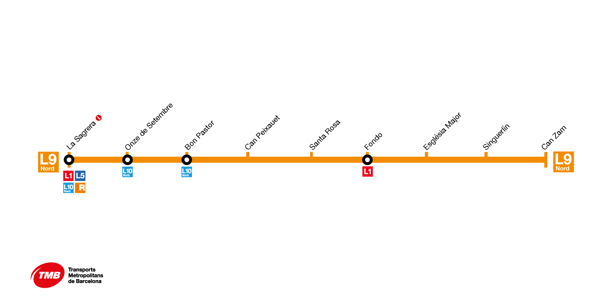
L9 Nord metro map
The L9 Nord, the northern section of the orange line, links Barcelona and the town of Santa Coloma de Gramenet.
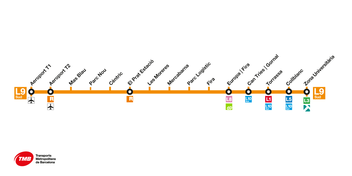
L9 Sud metro map
The L9 Sud, the southern section of the orange line, goes through Barcelona, L'Hospitalet and El Prat de Llobregat and it links the Zona Universitària district with the airport.
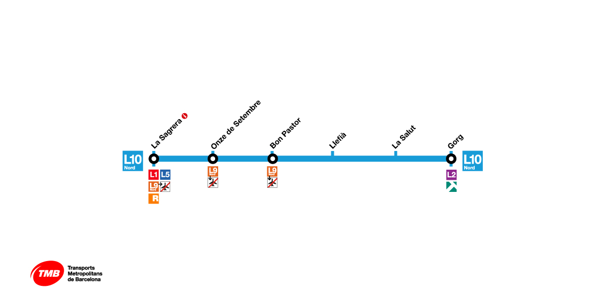
L10 Nord metro map
Line 10 Nord, the northern section of the light blue line of the Barcelona metro connects the municipalities of Barcelona, Santa Coloma de Gramenet and Badalona.
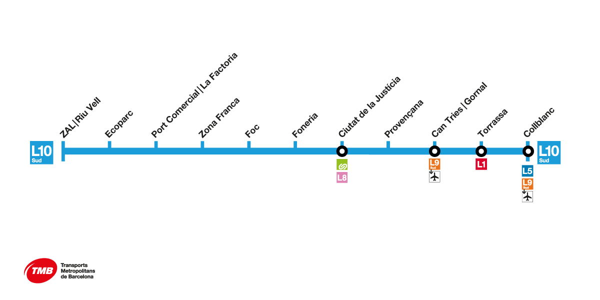
L10 Sud metro map
Line 10 Sud, the southern section of Barcelona's light blue metro line, connects the municipalities of Barcelona and L’Hospitalet del Llobregat, passing through the districts of Marina, Santa Eulàlia, La Torrassa and Collblanc.
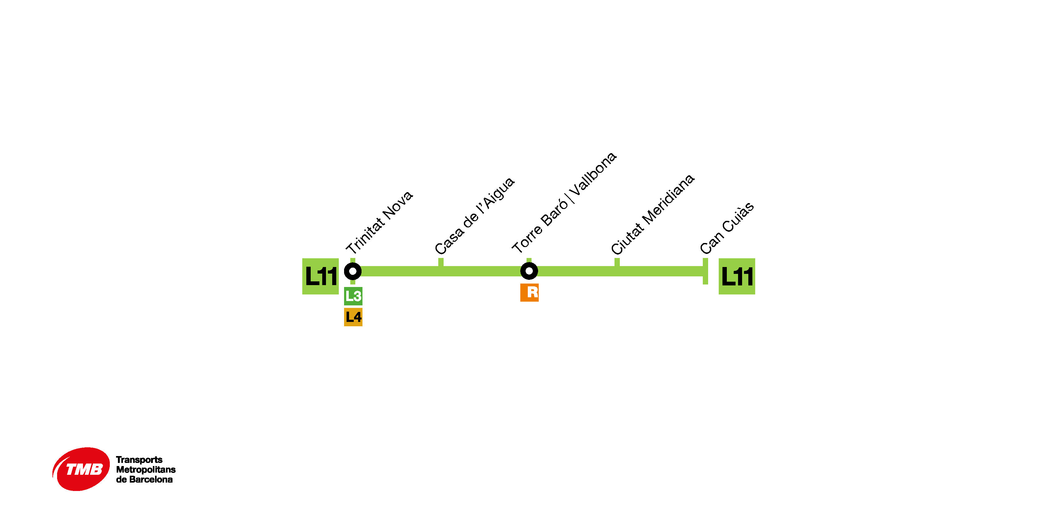
L11 metro map
Barcelona's light green metro line, Line 11 links the district of Nou Barris in Barcelona with the town of Montcada i Reixac.
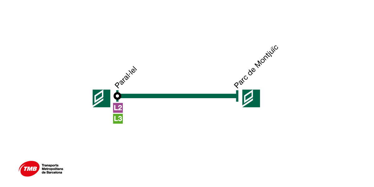
Funicular de Montjuïc map
The Montjuïc funicular links Barcelona with Montjuïc mountain. It has two stations: Paral·lel, which links up with metro lines L2 and L3, and Parc de Montjuïc, which links up with the Montjuïc cable car.
-
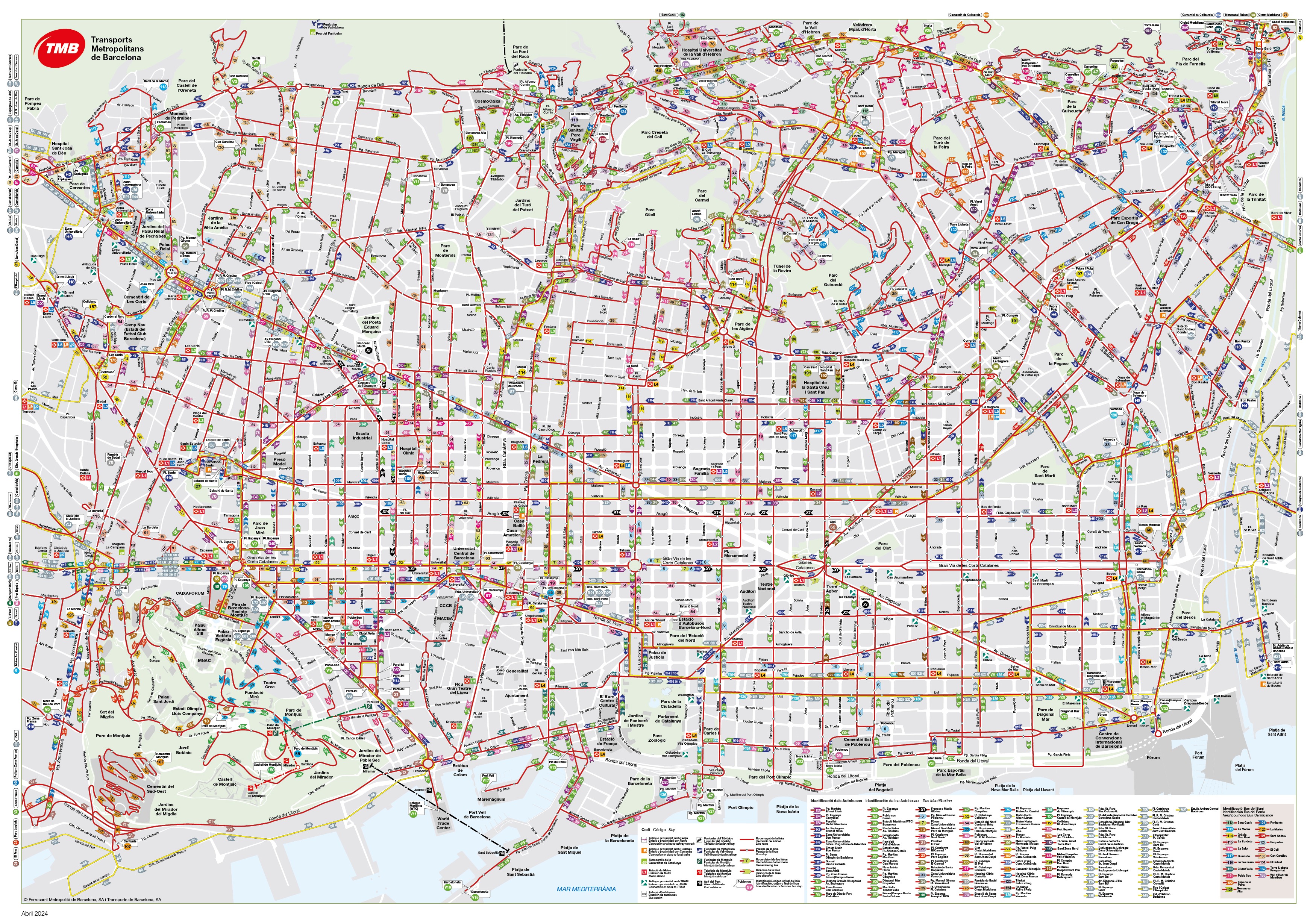
Barcelona bus network map
Find information on Barcelona buses, stops and interchanges to the metro, FGC urban railway, Rodalies de Catalunya mainline trains and TRAM, and plan your journey.


 Metro
Metro
 Bus
Bus
