How to use the NBN
The colours, letter and number combinations of each line, vehicle design, exchange hubs, stop signage... everything is designed so that users can quickly become familiar with the new bus network.
The pages below contain detailed information for fuss-free travel.
How do I identify bus routes?
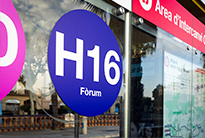
The names of the routes of the new bus network are not random, but rather follow a system to make it easier to identify and locate them on the map.
Routes starting with the letter H run in the Llobregat-Besòs direction. The even numbers in the route name indicate whether they run closer to the mountain (lower numbers) or to the sea (higher numbers). Therefore, H10 runs closer to the sea than H8.
Routes starting with the letter V run both ways between the sea and the mountain. The odd numbers in the name indicate whether they run closer to the Llobregat (V3) or the Besòs (V27) rivers.
The routes starting with the letter D run diagonally and use numbers 20, 40 and 50. For example, route D20 connects Passeig Marítim with Carrer d'Ernest Lluch.
The route colors also help to identify the journey: green, for the sea-mountain routes; blue for the Llobregat-Besòs routes, and lilac for the diagonal routes.
How do I identify the vehicles?
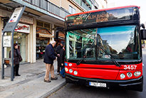
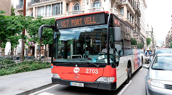
Buses operating on the new bus network display the new numbers on the front information panels, with the appropriate letter (V, H or D) and the relevant route number.
To start with, some of these buses were given a different exterior 'look' from those operating the conventional routes inspired by the grid system of the streets of the Eixample. Now, these vehicles are completely integrated into the transport network without any special distinction.
How do I interpret bus stop signage?
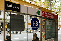
Bus stops have signage with a differentiated image and are named to be representative of their location to make it easier to get your bearings. If you are connecting with other transport systems, the name of the stop is the same (Metro Alfons X, Maria Cristina, etc.).
At bus stops, the routes are shown in a sequential thermometer format similar to the the metro, highlighting route interchange stops.
The busiest stops have information panels set into the bus stop shelter or on a solar pole, showing the anticipated arrival times of the next buses and providing service information.
Some stops (the first phase includes Espanya and Universitat on the H12) have large format touch-screen panels for planning your route as well as looking for real-time service information.
The interchange areas have supplementary signage and information to help guide passengers.
How do the interchange areas work?
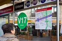
An interchange area is an urban zone where two or more routes on the new network cross over in both directions, and where the bus stops have been placed close enough to one another to make it easy for users to walk between them and continue with any journey that requires a change.
The interchange areas follow the same logic as connecting stations on the metro: each route runs both ways between two terminal stops, and so when you get off one bus you need to look for the stop of the route you wish to transfer to, bearing in mind the final destination. There is signage on both the bus stop shelters and on the ground indicating the routes between stops.
On the upper part of the glass of the bus stop shelter, it shows you the direction you need to follow and the name of the street where the stops are located in both directions of the route or routes you are able to connect with. You will also find a map there of the interchange area showing the location of the stops and directions for getting to them. While transferring, you will find directions to reconfirm that you are going the right way, such as a circle showing the route number and end destination and an arrow indicating the path to follow.
How do I plan my journey?
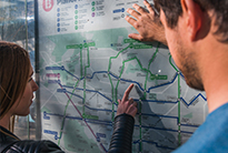
There are different options for planning your journey:
- Find a bus stop with a shelter; there you can check the bus network map and, if it is a stop on the new network, you will also find a differentiated map with the new routes shown.
- If you use mobile devices, learn more and plan with the TMB App application or through our website. On both the application and the website you will find the tools Journey planner and iBus Next bus.
- Access the information on the bus network and consult route details, timetables and the general map of the bus network.
- For any queries, information and customer service is available through the Twitter account @TMBinfo on working weekdays between 7:00 and 20:00 (using the hashtags #metrobcn and #busbcn). You can also ask questions using the form you will receive a response at the email address that you provide.
How can the information assistants help us?
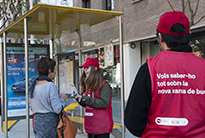
Over the first few days of the new routes coming into operation, there will be support from a team of over two hundred and fifty information assistants. Faced with new information about bus routes, stops and numbers, you can ask them questions and for advice before boarding the bus that will take you to your destination.
The mission of these staff is to acquire in-depth knowledge of the features of the new bus network and know how to explain it to users. The other purpose of these teams is to distribute explanatory leaflets, both generic ones for the entire new network as well as specific ones for each of the new routes.
How do I identify them?
The information assistants of the new bus network wear easily recognizable red vests and caps in the same color.
Where can I find them?
The information assistants are distributed throughout different points of the city, mainly at new stops and at certain of the interchange areas. During the days leading up to the introduction of the new routes they will also provide information about stops on routes that have been modified or replaced. They are organized to work in shifts during the mornings and afternoons.
The people carrying out information tasks out on the street are a central element of the information campaign, which involves hanging banners, distributing posters in doorways and at bus shelters, giving out leaflets and broadcasting information and messages through other channels such as websites, MouTV and social media.


